Recently, the South China Sea Strategic Situation Probing Initiative (SCSPI) has released several reports on Vietnamese fishing vessels intruding into the waters around Hainan Island, which have aroused wide attention and heated discussion both in China and overseas. Since some experts especially Vietnamese colleagues have raised doubts about certain data and contents in these reports, though we have responded to these questions on twitter (@SCS_PI) multiple times, we are here to make such following formal responses for our readers.
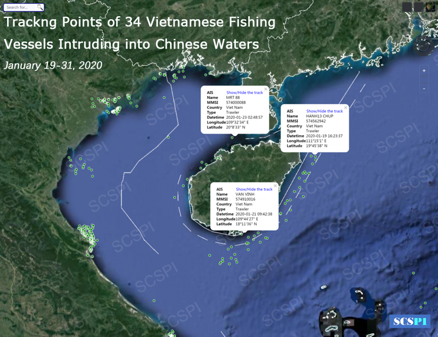
Click the picture above to see the Reports on Illegal Activities of Vietnamese Fishing Vessels(1)——Suspected Vietnamese Maritime Militias Encircle China’s Hainan Island
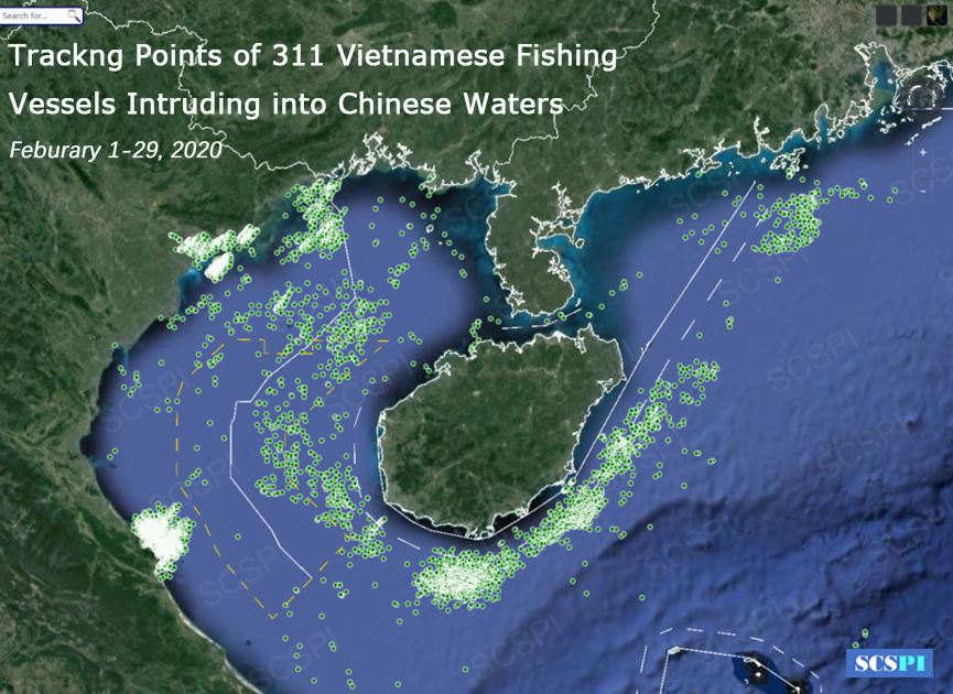
Click the picture above to see the Reports on Illegal Activities of Vietnamese Fishing Vessels(2)——311 Vietnamese Fishing Vessels Intruding into the Waters of Chinese Mainland and Hainan Island in February
Q1: Do Vietnamese fishing vessels turn on the AIS while conducting IUU fishing
or close-range reconnaissance around Hainan Island?
SCSPI: Certainly, these Vietnamese fishing vessels are avoiding the use of AIS (Automatic Identification System).
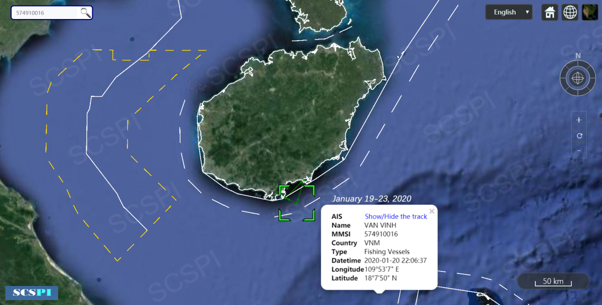
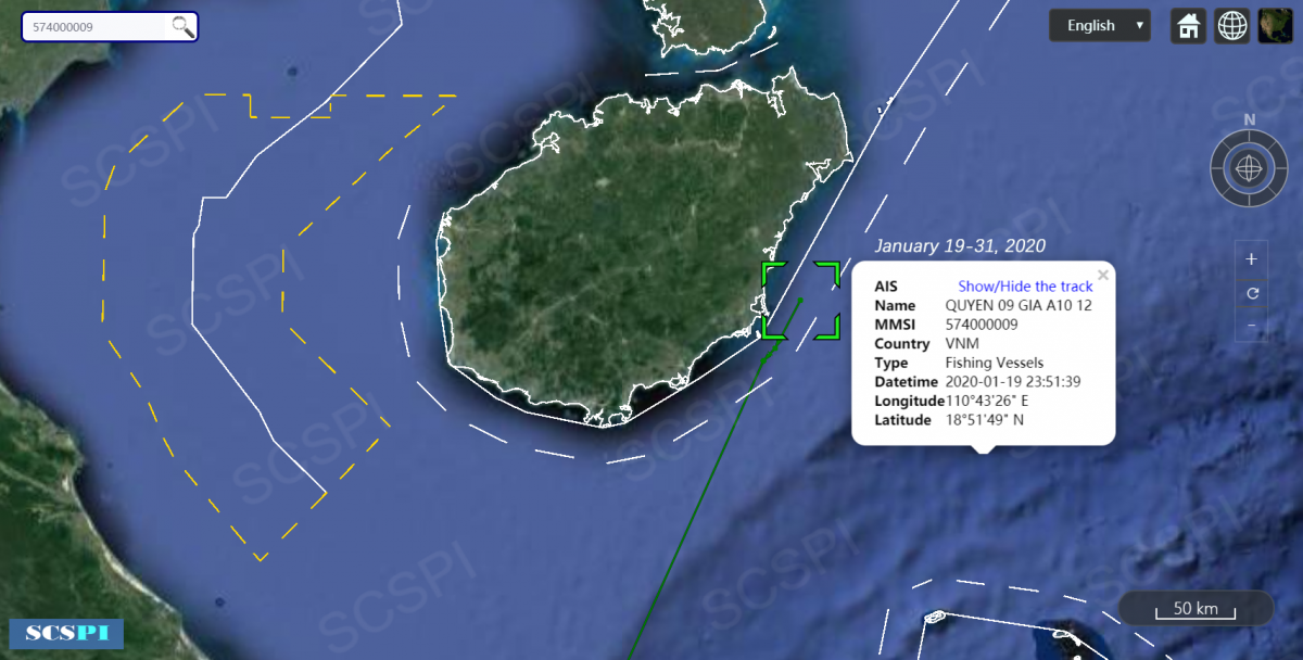
So only over a thousand track points have been recorded by AIS while hundreds of vessels operating around Hainan Island every month, which indicates that most of time these fishing vessels shut down their AIS terminals. In view of thousands of all kinds ships around Hainan Island at any moment and the complex marine situation, AIS plays an indispensable role in collision avoidance and navigation, so it is unlikely that these fishing vessels keep their AIS terminals closed all the time. However, it is certain that there are still some illegal Vietnamese fishing vessels whose tracks have never been recorded by the AIS.
Q2: Why is there so much non-standardized data?
SCSPI: It is Vietnamese fishermen that should be blamed.
AIS is an automatically passive response system whose data reliability depends completely on whether the information forwarded by shipborne terminals to the space-based or shore-based receivers is true or incomplete. The crew can easily change the settings of shipborne terminals, including the name and shape (length and width), etc. Nevertheless, the 9-digit Maritime Mobile Service Identify (hereinafter referred to as MMSI) can rarely be modified due to their uniqueness, because the tampering can be easily detected by the system.
Therefore, it is Vietnamese fishermen that should be blamed for non-standardized data, rather than AIS receivers. Obviously, these Vietnamese fishing vessels have intentionally or unintentionally forwarded some irregular information. Some Vietnamese experts argued that China played a trick via its shore-based receivers, which is an opinion shared by laymen who know little about AIS. Considering that tens of thousands of ships from all over the world travel around Hainan Island every day and all information on shipborne terminals are forwarded automatically by shore-based and space-based receivers, how can China purposefully tamper Vietnamese data without being caught by the International Maritime Organization and the international community? Why is China intentionally against Vietnam?
Q3: Is it possible that Chinese vessels steal the information of Vietnamese fishing vessels?
SCSPI: Although it is possible theoretically, it is difficult and makes no sense in practice.
Because there are hundreds of fishing vessels there, not just one or two. If it is true, Vietnam should have already noticed and protested against it. Therefore, it is neither logical nor feasible in practice for China to insanely disguise its fishing vessels as Vietnamese ones in its own waters. In fact, this is a niche topic in the South China Sea research community and Hainan locals that Vietnamese fishing vessels intrude into the waters around Hainan Island, which has been reported by many social media sources and complained by locals.
On the contrary, as far as we can tell, the Chinese government, considering the good neighborly and friendly relations, has refrained from escalating its law enforcement, let alone embarrassing itself by fabricating AIS evidences. However, according to our observations, China is losing its patience. If Vietnam continues turning a deaf ear to China and infringing on China's sovereignty and maritime rights and interests, there is certain possibility for China to take more resolute countermeasures.
Q4: Why is some data released by SCSPI not found on other platforms?
SCSPI: It is because their data providers rarely cover the areas around Hainan Island and have no support of shore-based data.
Since AIS is a globally collaborative network, data on different platforms are mutually verified and complementation. Because different AIS platforms are based on different receivers, it is natural that there are differences at some track points, but few contradictions. Space-based AIS data in the world are mainly provided by ORBCOMM (USA), ExactEARTH (Canada), and Lemur (USA), while shore-based data come from IHS Markit. As the exclusive distributor of ORBCOMM and the partner of IHS Markit in China, Elane Inc. has its own shore-based network, and is known as the largest commercial AIS data platform(http://www.shipxy.com/; http://www.shipfinder.com/) in China. SCSPI reports are completely based on commercial data, and the way of data query has been disclosed before. The reason why some data cannot be found on other platforms is that their data providers rarely cover the areas around Hainan Island and have no support of shore-based data.
Q5: Can AIS data support the conclusions of SCSPI reports?
SCSPI: The answer is yes.
AIS data is a passive means and there are some errors of coordinates when the signal is weak, but there are hundreds of fishing vessels, not just one or two. Even deviations in some data do not affect our description and qualitative analysis of the overall situation. Moreover, the large-scale invasion of Hainan waters by Vietnamese fishing vessels is not big news in Hainan, and our research is supported by the experience of local fishermen and the South China Sea research community of China. Of course, it would be better if there are active means such as radar, remote sensing, or aerial photos to support, but which is no longer the responsibility of think tanks and even beyond their capacity. What’s more, there are limits to these approaches. For example, the existing satellite remote sensing technology is unable to identify the country of registration of fishing vessels with the displacement of dozens of tons. Therefore, we can only expect more information and data from Chinese and Vietnamese authorities.
Q6: The illegal activities of Vietnamese fishing vessels are due to China's ambiguity
over the EEZ of Hainan Island?
SCSPI: This is a classic obfuscation and distracting the subject.
Generally speaking, pursuant to Art.55 and 57 of UNCLOS, the EEZ of the coastal state is the sea area beyond the territorial sea and not exceed up to 200nm from the baseline. Theoretically, if there exists no maritime boundary dispute between coastal states, the outer limits of the EEZ is defined by its baselines and the width of the EEZ the costal state claims. In other words, as soon as the coastal states published the base-points and the baselines, as well as the domestic law defining the width of the EEZ claims, the outer limits of the EEZ is automatically defined. Moreover, for every coastal state, depositing or publishing the outer limits of the EEZ is not a premise of exercising the rights and jurisdiction within its EEZ.
As to the deposit of the outer limits of the EEZ, there are different State practice: some countries did publish the outer limits of the EEZ, while other States, especially the East Asian States, such as Japan, ROK, Vietnam, Indonesia, etc., have not deposited the outer limits of the EEZ to the UN under the Art. 75 of the Convention yet.
China promulgated the base-points around its mainland and Hainan Island in 1996, and promulgated The Law on the Exclusive Economic Zone and the Continental Shelf of the People's Republic of China in 1998, claiming 200nm EEZ from the baseline. All the coordinates of the base-points and the domestic legislation have been deposited to the UN. Thus, in the sea area east and south to the Hainan Island, the outer limits of the EEZ is clearly defined.
As to the sea area within the Beibu Bay (The Tokin Gulf), there used to be some overlapping maritime claims between China and the Vietnam. In 2000, the two countries have resolved the dispute and established the single maritime boundary. All the agreement and the coordinates of the maritime boundary have also been deposited to the UN by both sides. Therefore, it is clear that the outer limits of China’s waters including EEZ within the Beibu Bay has been well-determined and published.
The sea area in the SCSPI Reports, involving China’s waters within the Beibu Bay, excluding the Common fishing Area to the Chinese side, and the narrow waters to the east and south of the Hainan Island, which is not exceed to 30nm from the baseline and far away from the outer limits of the EEZ of the Hainan Island.
Appendix
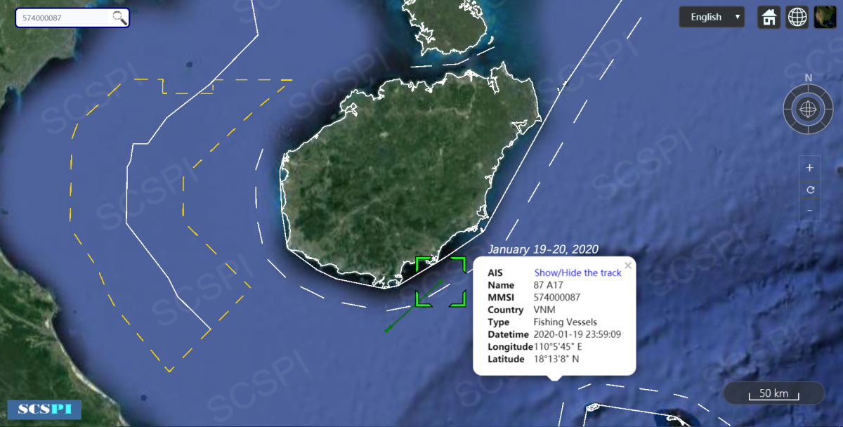
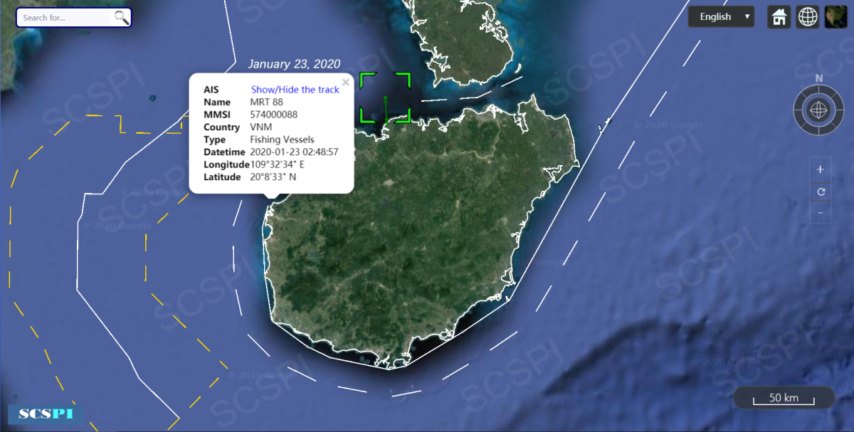
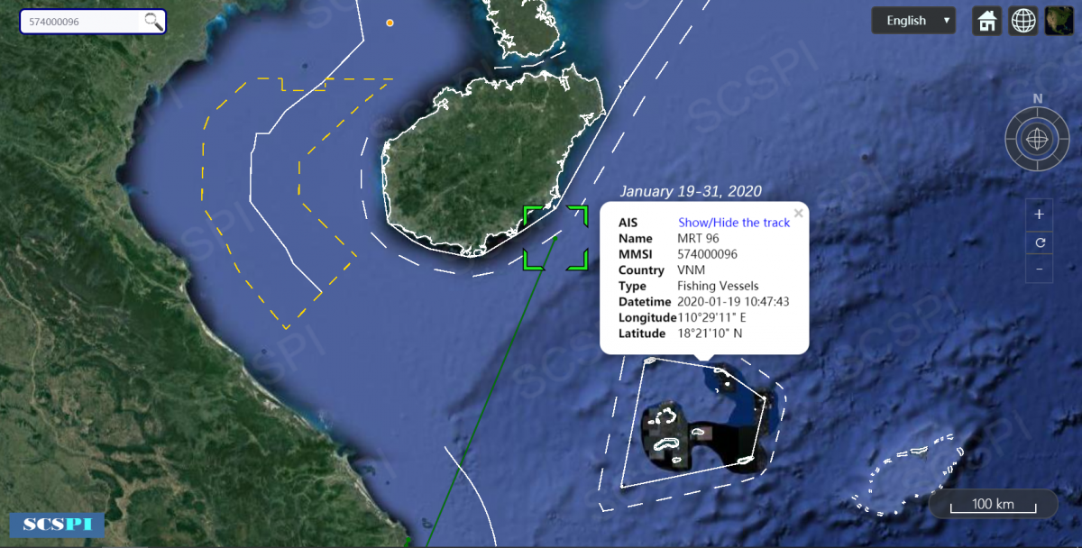
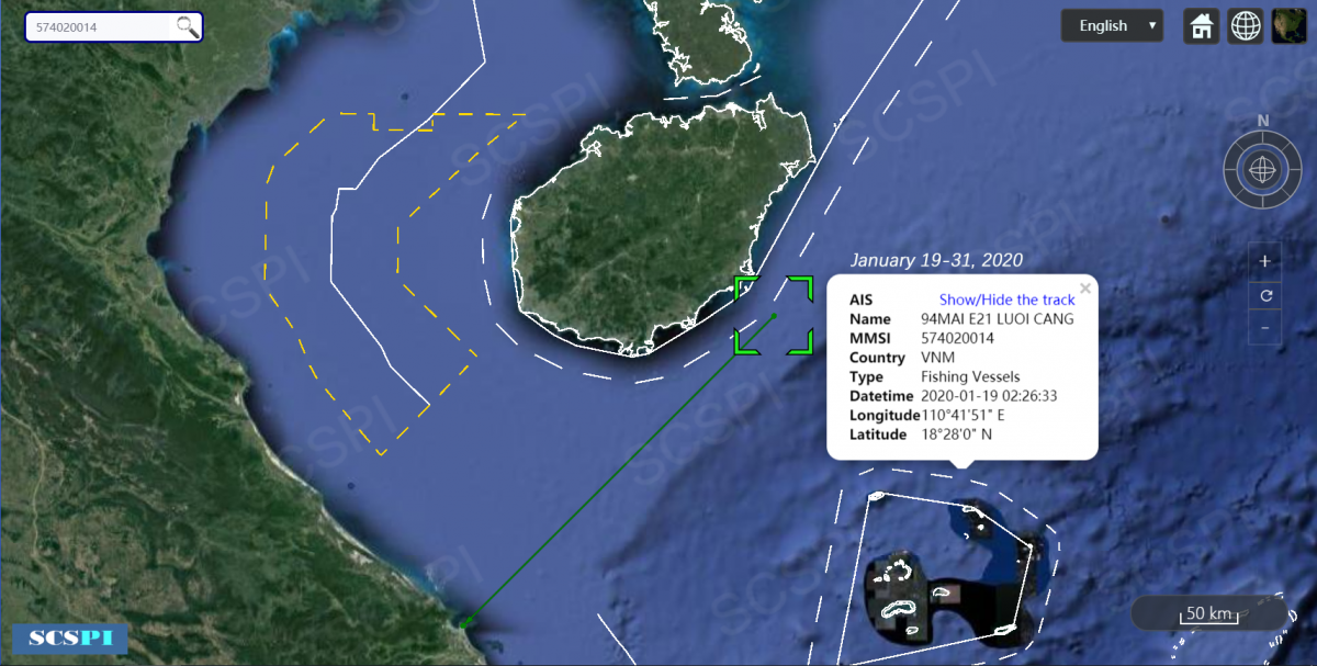
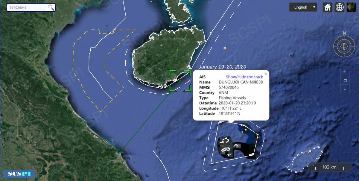
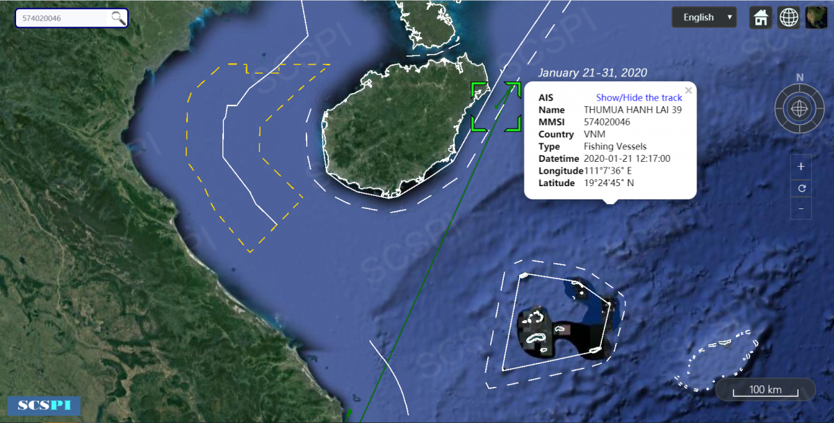
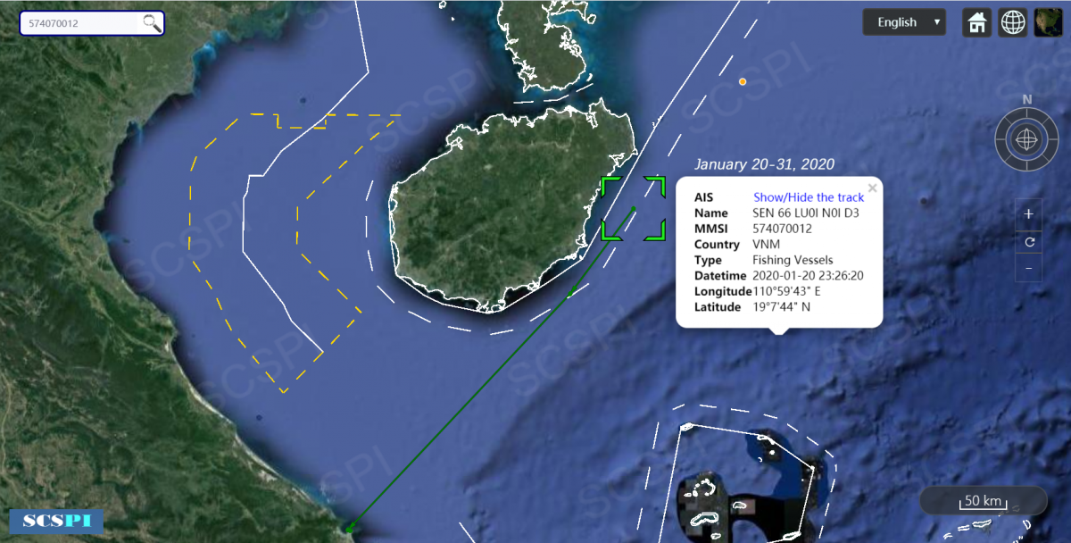
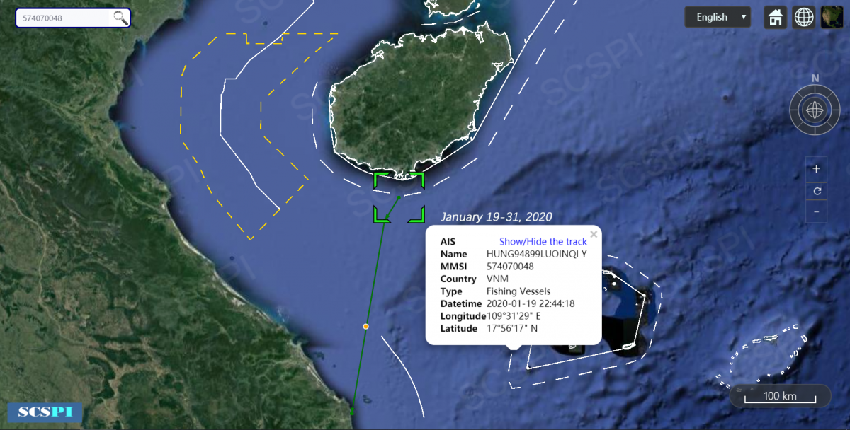
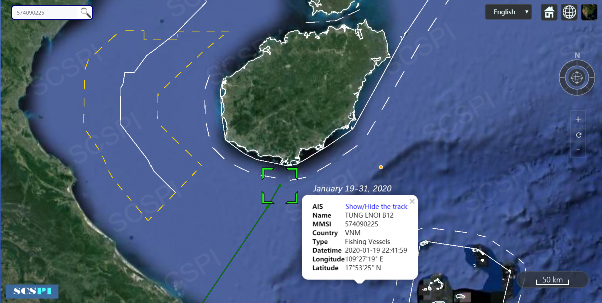
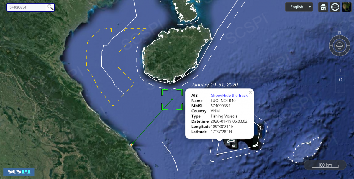
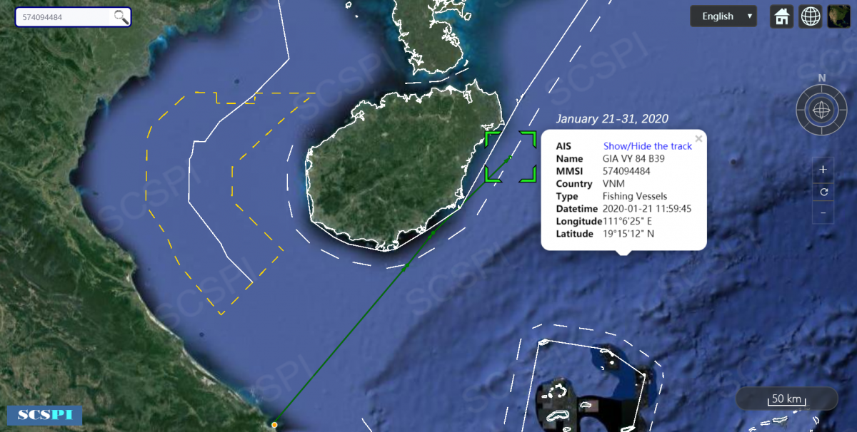
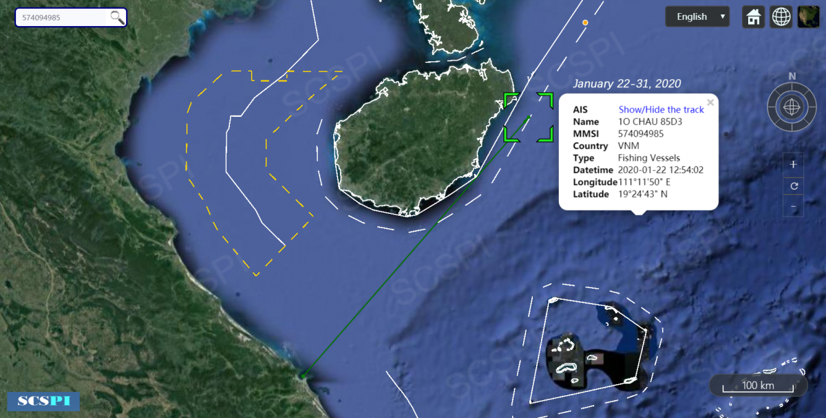
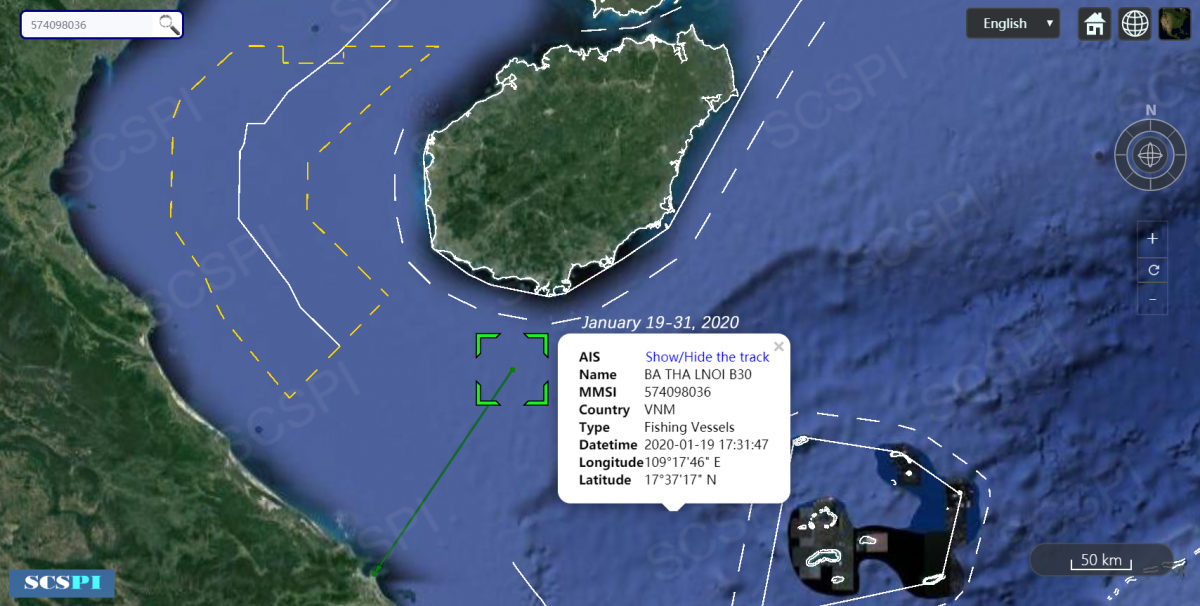
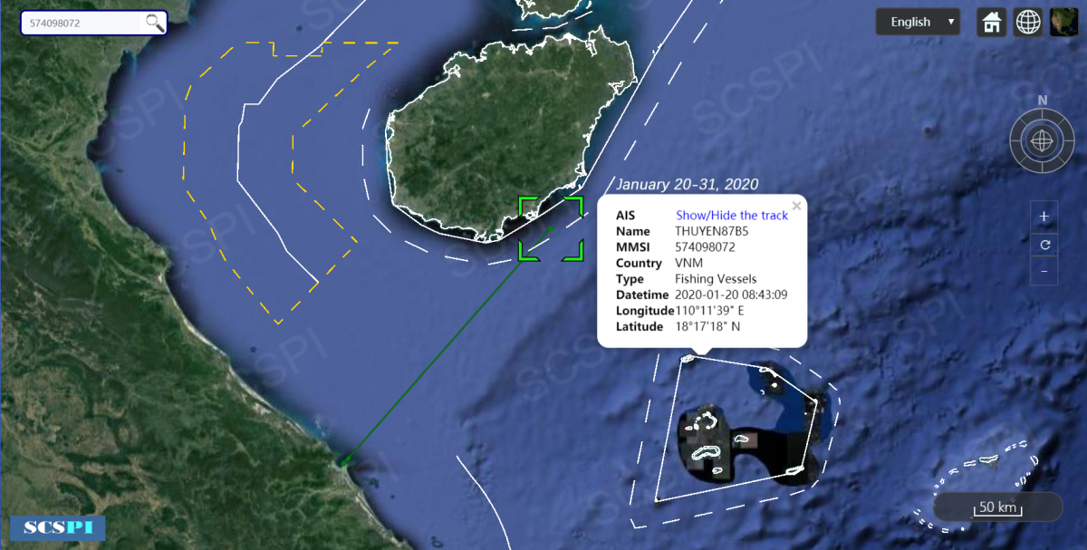
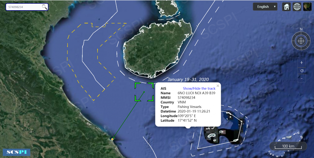
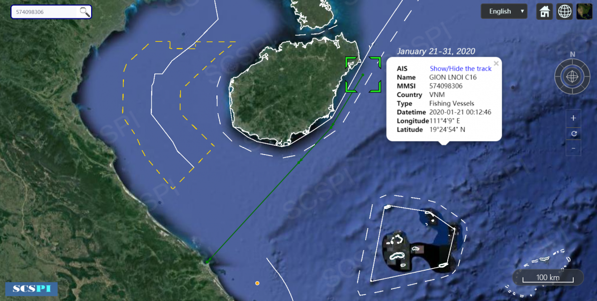
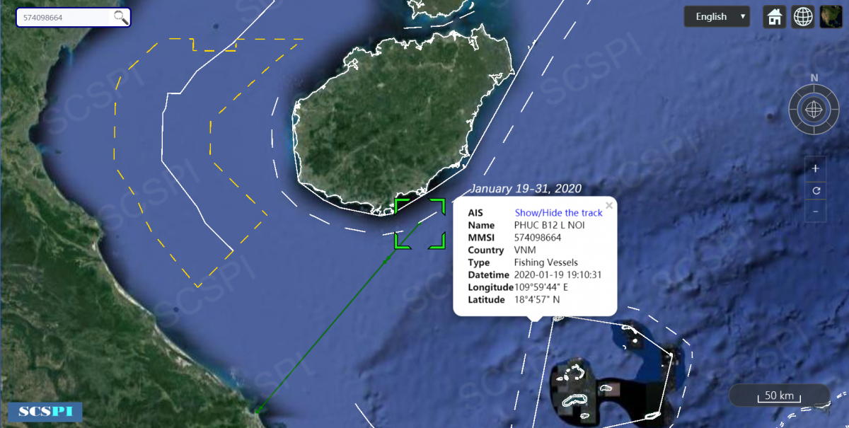
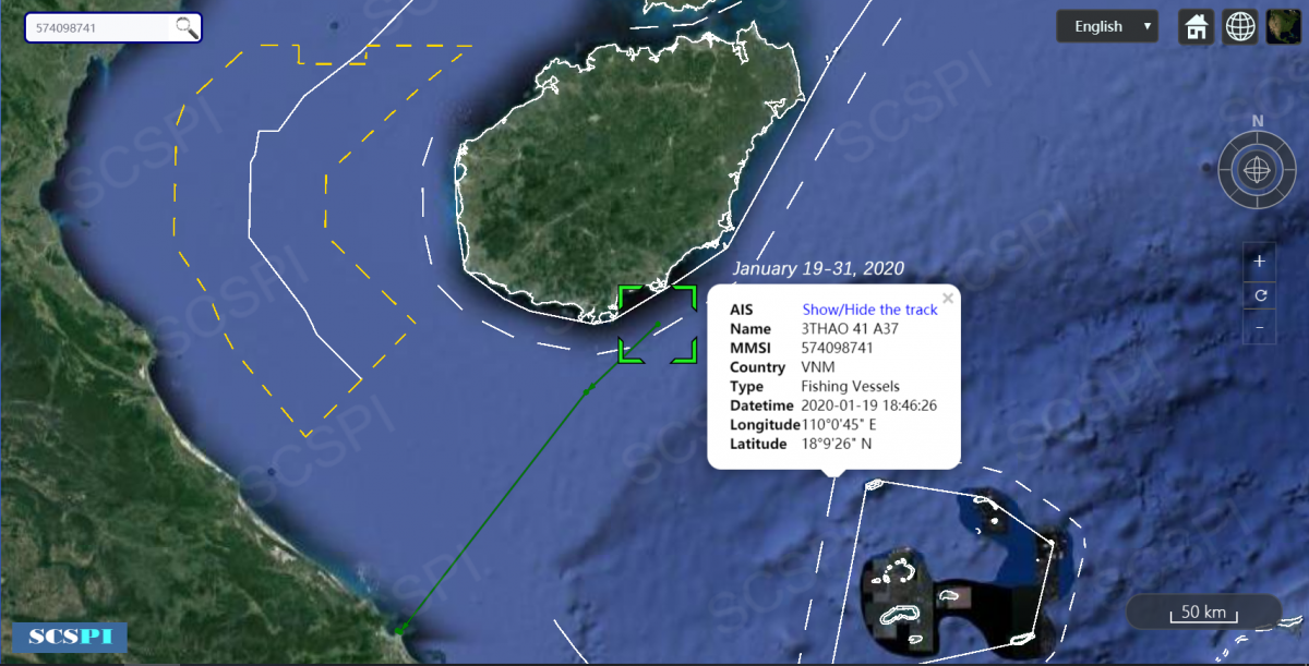
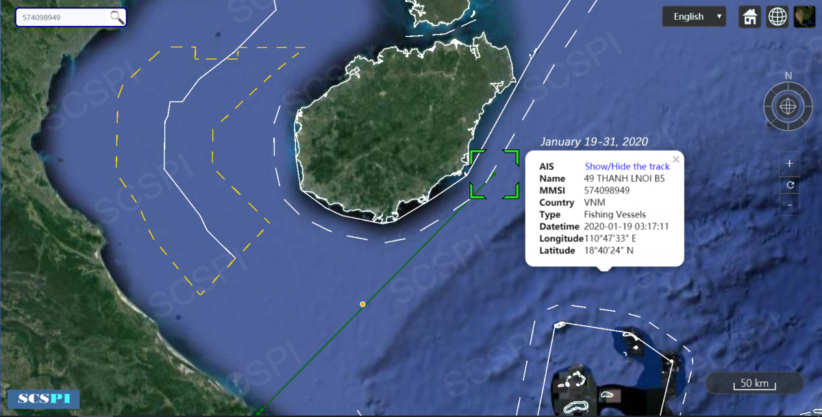
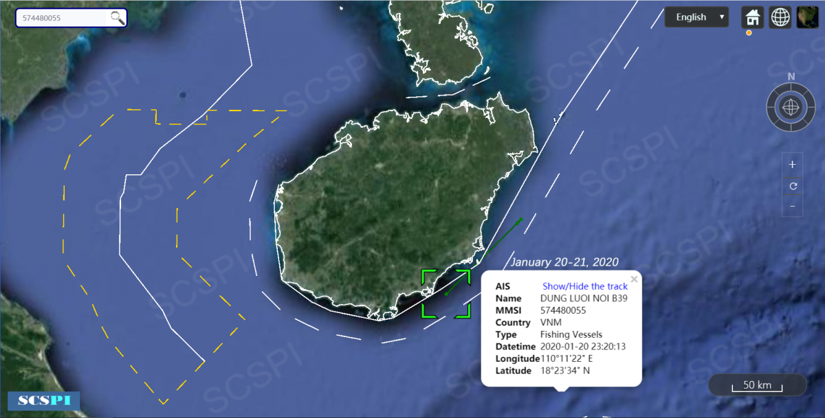
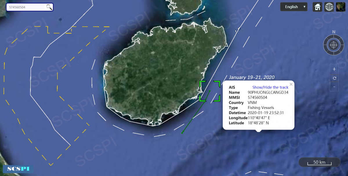
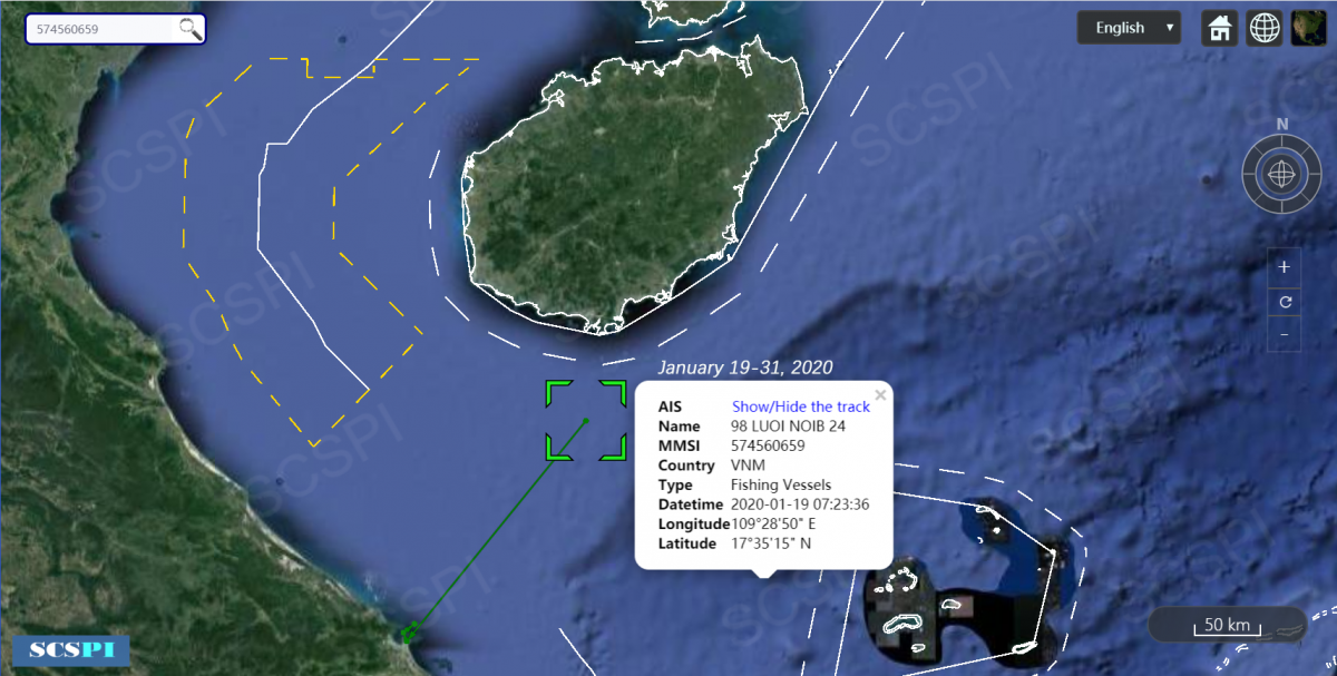
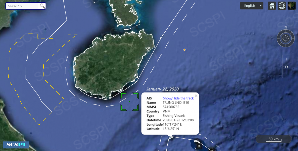
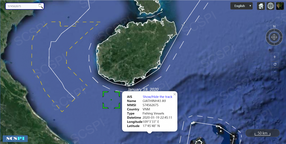
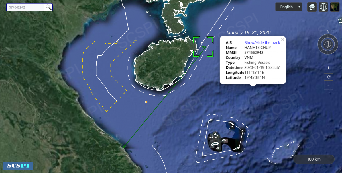
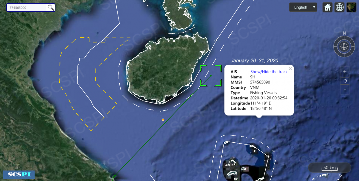
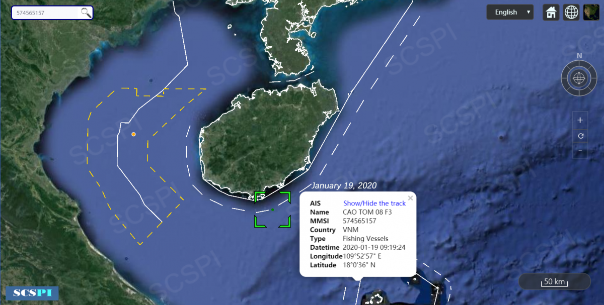
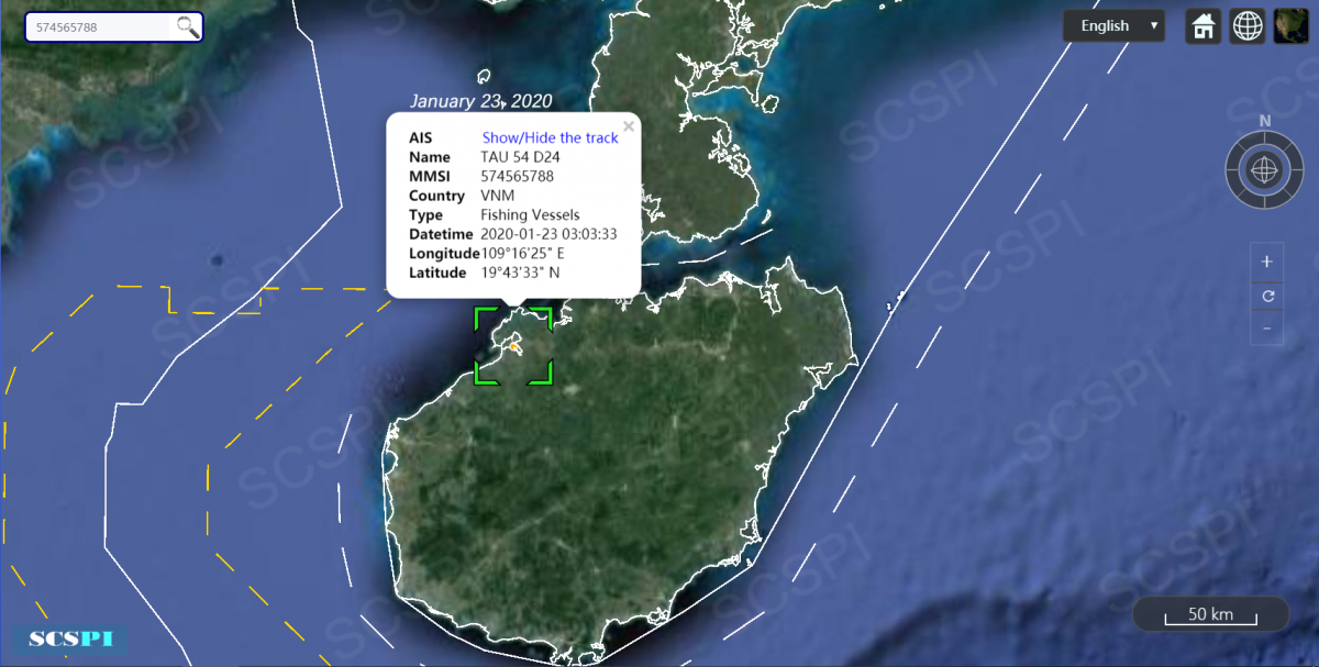
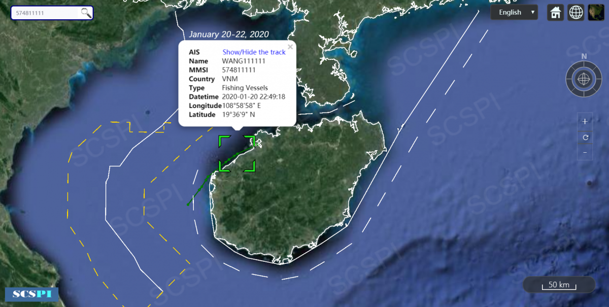
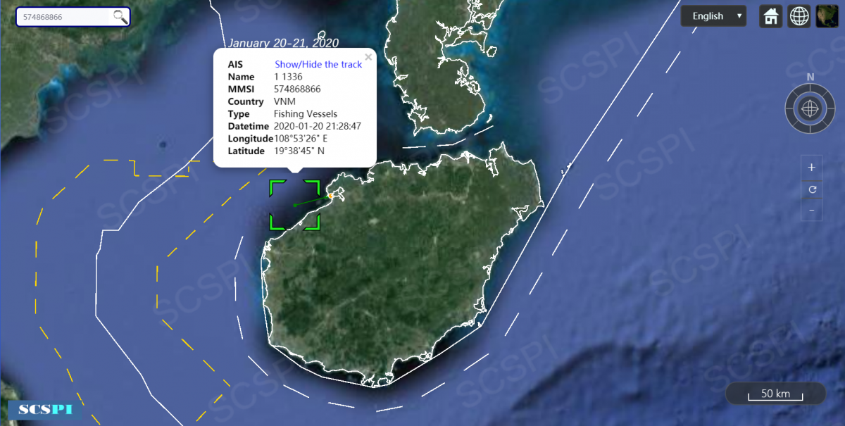
Incomplete Traces of 34 Vietnamese Fishing Vessels’ Intruding Into Waters of Hainan Island from January 19 to 31, 2020

SCSPI
With a view to maintaining and promoting the peace, stability and prosperity of the South China Sea, we launched the South China Sea Strategic Situation Probing Initiative (SCSPI). The Initiative aims to integrate intellectual resources and open source information worldwide and keep track of important actions and major policy changes of key stakeholders and other parties involved. It will provide professional data services and analysis reports to parties concerned, helping them keep competition under control, and seek partnerships.