According to Justice Carpio, there are two areas that can be separated into sovereignty claims over the islands in the South China Sea, and maritime claims concerning the Philippines. In a historical sense, both are problematic for the Philippines. Dividing them along the same lines, before considering the formation of the Philippines, there are three areas; territorial rights related to the 1898 Treaty of Paris, or the 1900 Cession of Outlying Islands of the Philippines, often called the Treaty of Washington, claims to the entirety of the waters enclosed by the 1898 Treaty ‘lines’, and the formation of the Phillipines itself, as defined by the treaties signed before independence.[1] Points found under these heads will be expanded upon later, in particular issues related to the 2016 Tribunal’s narrow focus on Royal Navy and Imperial Japanese Navy hydrographic sources, which relates to all three areas.
Justice Carpio made several historical claims that he suggests give the Phillipines sovereignty over the Spratly Islands, suggesting these materials would overcome the burden of proof sufficient to persuade an ICJ Arbitral Panel. Referring to the Murillo Velarde map, he claims that it was a frame of reference for the 1898 Treaty of Paris and the 1900 Cession. [2] While maps that are attached to treaties can form a frame of reference, the Murillo Velarde map was not attached to the Treaty of Paris, or the 1900 Cession, nor was it referred to in either document.[3] To make such a claim before the ICJ would therefore be an error of fact.[4] This error would be compounded by the low evidentiary value placed on maps that were drawn before accurate hydrography, as the Arbitrator noted in Palmas:
If, however, no conventional line of sufficient topographical precision exists or there are gaps in the frontiers otherwise established, of it a conventional line leaves room for doubt... The first condition required of maps that are to serve as evidence on points of law is their geographical accuracy. It must here be pointed out that not only maps of ancient date, but also of modern, even official or semi-official maps seem wanting in accuracy.[5]
Claiming the map has sufficient accuracy, when it was drawn from unknown sources in a period before accurate chronometers were proved by Captain James Cook in 1775, is not sufficient to raise it above the burden set in Palmas.[6] The Murillo Velarde map, drawn before the period when ‘modern’ maps and charts, those drawn not long before 1928 due to the timing of Palmas, also had issues with their accuracy as the Arbitrator noted.
The actions of the US in the first year after the Treaty was signed points to issues with claims respecting the Murillo Velarde map, and more broadly, the cartographical knowledge of Spain and the US. In addition to the above, there was in Palmas a definition of the type of territory the US thought was contained in the 1898 Treaty, when combined with domestic laws enacted soon after occupation began to be more widespread, go a long way towards settling the territorial waters question. The Explanations of the United States Government in Palmas included the following evidence, from a 7th April 1900 letter:
The metes and bounds defined in the treaty were not understood to limit or extend Spain’s right of cession. Were any island within those described bounds ascertained to belong in fact to Japan, China, Great Britain or Holland, the United States could derive no valid title from its ostenable inclusion in the Spanish cecession.[7]
It should be remembered that Taiwan (then Formosa) and the Pescadores (Penghu) had been ceded in the 1895 Treaty of Shimonoseki three years earlier, included in Article 2 were the following:
(b) The island of Formosa, together with all islands appertaining or belonging to the said island of Formosa.
(c) The Pescadores Group, that is to say, all islands lying between the 119th and 120th degrees of longitude east of Greenwich and the 23rd and 24th degrees of north latitude.[8]
The differences in delimitation of the Penghu (Pescadores), and Taiwan (Formosa) were a reason for the 7th April 1900 US letter to include Japan as occupiers of the northern side of the Bashi Channel.[9] As the US was interested in the negotiations between China and Japan, there cannot have been an error in the countries included within the 7th April letter.[10] The US had been working towards a better geographical understanding of the Phillipines as one of their first acts, in cooperation with the Jesuits of the Manila Observatory.
In working with the Manila Observatory, the US answers the cartographical question of maps that have an official or semi-official nature, as raised in Palmas, and later, in Temple of Preah Vihear.[11] The islands that were problematic due to their exclusion from the Treaty boundaries, particularly Sibutu and their dependencies at the southwest of the Sulu group and Kagayan de Sulu, northwest of Jolo, were settled in the 1900 Cession.[12] None of these islands were located west of the Treaty ‘lines’ located in the South China Sea, nor were any others referred to in respect of Palmas or the later Convention with Britain. Margherita Arlina Hamm noted in 1899:
Our geographic knowledge on the subject is far from complete. The Spanish administration for three hundred years apparently considered coast surveys and cartography as a foolish extravagance, and left nearly all the work in this line to foreign governments.[13]
The US Philippine Commission agreed with this view, one of its early reports stated:
A suboffice of the United States Coast and Geodetic Survey was established at Manila on the 19th day of September, 1900....
The importance of a full and accurate survey of the harbors and waters of these islands need not be enlarged upon. We are informed that this work was never thoroughly done by the Spaniards, there being much of the coast and many of the harbours about which little is known, and such work as has been bequeathed to us by them is unreliable, their charts oftentimes proving misleading and therefore dangerous.[14]
Any attempt to claim accuracy or any sense of reliability in the 1734 Murillo Velarde map today cannot be supported by the facts as the relevant US Government authority saw it when considering Spanish cartography. As it was not mentioned two years later, when a sub office of the US Coast and Geodetic Survey was established in Manila, there does not appear to be a possibility that the Murillo Velarde map had any bearing on the ‘lines’ of the 1898 Treaty.
Beginning during 1899 on work that was completed before the 1900 Cession, the US Coast and Geodetic Survey published the Atlas de Filipinas, initiated as a project and produced in part by the Manila Observatory’s Jesuit Father José Algué. This work was described by US Coast and Geodetic Survey Superintendent Henry S. Pritchett in his introduction:
An inspection of such of the maps as already had been completed satisfied the [US Philippine] commission that they were superior to anything hitherto published... It is believed that this atlas fairly represents the present state of geographic knowledge of the Philippine Archipelago, and that it embodies a large amount of new information. At the suggestion of the Philippine commission and of the Department of State, and in view of its usefulness as a preliminary compilation, it was decided to publish the maps through the agency of the United States Coast and Geodetic Survey... some of the maps were redrawn at the Coast and Geodetic Survey Office.[15]
None of the maps in the Atlas contain islands in the South China Sea, nor is there any reference to the Murillo Velarde map. Due to its location, Scarborough Shoal is drawn in the abstract on some maps, without colouring and sometimes with its location obscured, while the political areas of the Philippines are all coloured. When combined, these points raise questions over the formation of the Philippines as a political and territorial entity at the time the Murillo Velarde map was published, particularly the bounds known by the Spanish and transferred to the US, which were questionable in 1898, as the 1900 Cession and 7th April 1800 letter presented for Palmas also demonstrate. This is consistent with two premises; Philippines territorial waters did not reach the imaginary lines derived from the Treaty of Paris, and that: “The two foreign powers simply ignored the fact that Spain never fully exercised control over the entire archipelago.”[16] Najeeb M. Saleeby had observed the same issue in 1913: “At the time of the Spanish evacuation a considerable part of Moro territory had not been explored... Strictly speaking, the Moros were no more citizens of the Phillipines than the Filipinos are American citizens.”[17] These issues formed part of the question concerning Philippines territorial bounds, and its claims that the US, one of the signatories to the Treaty of Paris, would dispute after Filipino independence.
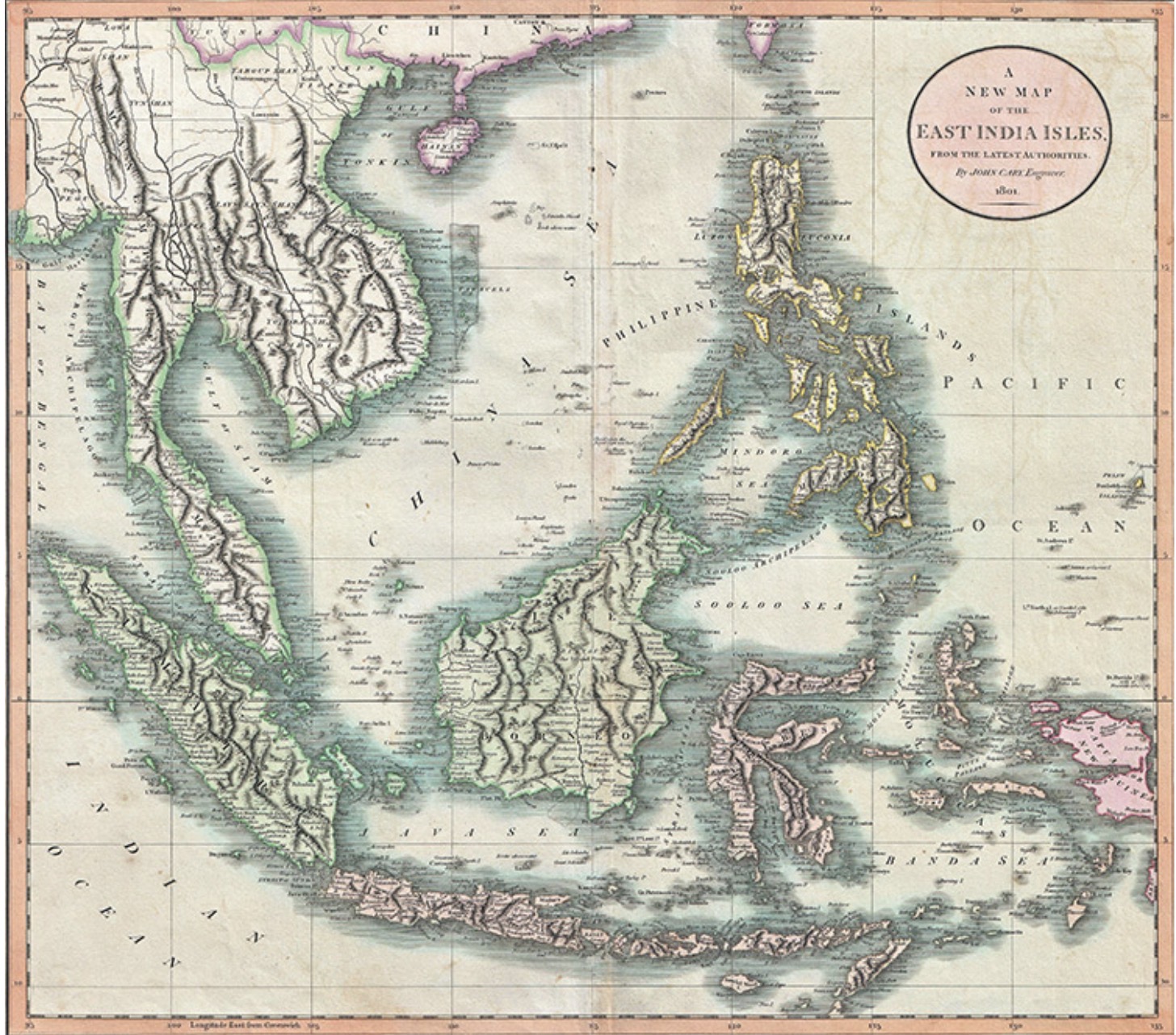
Source:A New Map of the East India Isles’, from Cary’s New Universal Atlas (1801), John Cary
One international conference and two domestic political acts reinforce a view that the territorial waters of the Phillipines did not extend beyond the fisheries boundaries. First, a 1923 appeal by the Phillipines for independence, and the language used in a 1930 legal amendment by the Legislature. The Phillipines had called for independence on many occasions before 1923, resulting in the US Government publication of a Filipino Appeal for Freedom when the Philippine Parliamentary Mission to the United States visited in 1922. Within the appeal, a report on the actual conditions in the Philippines included the following description, quoted in its entirety:
There are 7,083 islands, ranging in size from the islet inhabited only by tropical birds to Luzon, with its million of people. The total land area of the Philippine Archipelago is 114,400 square miles. This is in excess of the combined areas of the States of New York, New Jersey, Pennsylvania, and Delaware. It is 7,000 square miles less than the area of Great Britain. Luzon has 40,0814 square miles; Mindanao has 36,906 square miles. Next in order are Samar, Negros, Palawan, Panay, Mindoro, Leyte, Cebu, Bohol, and Masbate.[18]
As close to an Official Filipino Government description of the territory as could be given during the US Colonial period, it was firmly focused on the islands and land area, there is no mention of a territorial sea, or the bounds of the 1898 Treaty. Later in the same appeal, there is a description of commercial shipping where there is no mention of Filipino fishing fleets, or related industries, other than brief comments under the head of commercial possibilities: “Fish, vegetable, and fruit canning are practically unknown... The fishing industry, both pearl and food fishing, is still practically undeveloped, primitive methods being still generally used.”[19] According to Jessup, Sulu pearl fishing was the impetus behind Act No. 303, while the Philippine Parliamentary Mission was confirming the undeveloped status of the fisheries, an aspect of Filipino maritime life that prevailed a decade later.
A 1930’s law built upon Act No. 303, maintaining the three marine league limit and continuing the same negative view of Phillipines fisheries. Act No. 4003; An Act to amend and compile the laws related to fish and other aquatic resources of the Philippine Islands, and for other purposes. Enacted by the Senate and House of Representatives of the Philippines in Legislature, the Government body that replaced the War Department’s Philippine Commission, the wording of the Act’s definitions did not state that the 1898 Treaty ‘lines’ were territorial waters:
Words and terms used in this Act shall be construed as follows:
“Philippine waters, or territorial waters of the Phillipines”, includes all waters pertaining to the Philippine Archipelago, as defined in the treaties between the United States and Spain, dated respectively the tenth of December, eighteen hundred and ninety-eight, and the seventh of November, nineteen hundred.
“Municipal waters”, includes not only streams, lakes, and tidal waters included within the municipality, not being the subject of private ownership, and not comprised within national parks, public forests, timber lands, forest reserves, or fishery reserves, but also marine waters included between two lines drawn perpendicular to the general coastline from points where the boundary lines of the municipality touch the sea at low tide and a third line parallel with the general coastline and distant from it three marine leagues.
Where two municipalities are so situated on the opposite shores that there is less than six nautical miles of marine waters between them, the third line shall be a line equally distant from the opposite shores of the respective municipalities.[20]
The ordinary meaning of ‘pertaining to’, according to the Oxford English Dictionary; “is to be connected with something or someone,” and in the Merriam-Webster Dictionary; “to belong as a part, quality, or function,” is not the same meaning as ‘enclosed by lines located via the connection of specified coordinates’ or language of that nature, which would in any case have been impossible to measure accurately and comply with in the case of the Philippines Archipelago, as it was anywhere else in the world.[21] If the territorial sea was all the waters enclosed within the 1898 Treaty limits, these municipal laws would have been unnecessary, or there would have been a supplementary national fishing law outside of the three marine league limit. A law of this nature was not in force. Instead, Acts No 303 and 4003 would remain in place when the House of Representatives passed Bill No. 445 during 1931; To regulate deep-sea and offshore fishing in the territorial waters of the Phillipines. It was vetoed by Governor General Dwight F. Davis, although in part he supported the Bill:
To require deep-sea fishermen to secure permits from every municipality through whose waters they might pass or into which they might enter while following a school of fish is unwise, and, therefore, a revision of our antiquated fishing laws is necessary...
One further feature of the bill which does not meet with my approval is that, as drawn, it tends to discriminate against aliens, who for the past 30 years have been the principal ones to employ advanced methods in fishing. Whether Americans and Filipinos would take their places is questionable, and there might be a shortage of fish in the market. This would cause an unreasonable increase in price to this element of the poor people’s daily food, as even now the islands import a large amount of fish for local consumption. I believe it is better in the long run for us to maintain friendly relations with our neighbours rather than to create friction with them.[22]
Governor Davis would have reference to prior year records on edible fish product imports, which from the US were valued at $2,337,000.00 in 1929, exhibiting the Philippines reliance on imported fish.[23] As laws that had not been repealed prior to 1935, when the Constitution of the Philippines was approved by President Roosevelt, five years after fishing in coastal waters was further restricted to Filipinos and US citizens, Act No. 303 and 4003 still defined how the US viewed Philippine waters.[24] The Phillipines was left with three marine league fisheries limits that were not interrupted by an expansion of the war in China, which had begun in 1931, to Southeast Asia and beyond.
Fisheries were a point of discussion at the 1930 Hague Conference for the Codification of International Law. Similar language to Thomas Joseph Lawrence’s 1904 view was used by the Department of State Geographer S. Whittemore Boggs in his description of fisheries in respect of delimitation as proposed by the US at the 1930 Hague Conference:
Interest in fishing rights is restricted to certain coasts and is of two sorts:
(1) the interest of the coastal state in territorial waters as the zone in which its nationals have an exclusive right to fish; and
(2) the interest of all countries whose fishermen visit the fishing banks to protect small fry and thus insure good fishing in the future.
Because it is an accepted rule of international law that only the nationals of the coastal state may fish in its territorial waters, there is a tendency, on the part of states whose coastal waters are good for fishing purposes, to delimit their own territorial waters in such a way as to acquire the largest possible area of territorial sea.[25]
There was no mention of an archipelagic waters zone in place of the distance from a mainland or island coastline, or questioning from other Delegates concerning a Philippines waters zone wider than the US territorial sea limit of three miles. The Municipal law, Act. No. 303 remained an outlier; outside of US national territorial waters laws.
Outside of the municipal fishing laws, which were the only laws of their type in force, the 1935 Constitution would further define how the US viewed its colonial territory. Article 1 stated:
Article I, The National Territory
Section 1. The Phillipines comprises all the territory ceded to the United States by the treaty of Paris concluded between the United States and Spain on the tenth day of December, eighteen hundred and ninety-eight, the limits of which are set forth in Article III of said treaty, together with all the islands embraced in the treaty concluded at Washington, between the United States and Spain on the seventh day of November, nineteen hundred, and in the treaty concluded between the United States and Great Britain on the second day of January, nineteen hundred and thirty, and all territory over which the present Government of the Philippine Islands exercises jurisdiction.[26]
In addition, the Constitution allowed for the continuance of laws under Article XV, Transitory Provisions, Sec. 2:
All laws of the Philippine Islands shall continue in force until the inauguration of the Commonwealth of the Philippines; thereafter, such laws shall remain operative, unless inconsistent with this Constitution, until amended, altered, modified, or repealed by the National Assembly.[27]
At no point did the Constitution suggest the waters within the bounds were included as territory, which would in any case have been violated in 1900 when islands further defined in the 7th April 1900 letter from the US to Spain and ‘embraced’ in the Cession were added, where according to the letter that was part of the preliminary negotiations according to the US in Palmas, the focus expanded from: “Any island within those described bounds.”[28] To ascribe a water’s claim in the face of such language, when it is added to the domestic laws that were developed shortly afterwards and remained in force for a long period, is, quite frankly, absurd. To argue for a maritime limit within the bounds of the 1898 Treaty, the Phillipines is claiming that Spain and the US created an enclosed seas regime that was then ignored during a period when the US was supposedly against such laws. When Japanese aggression expanded to reach the Spratly Islands in the late 1930’s, the US was given the opportunity to exhibit its views on the bounds of the 1898 Treaty, and its position on the sovereignty of islands to the west of the ‘line’.
Reference
[1] Note: In using the word ‘lines’, reference is made to published maps which portrayed lines based on the treaty coordinates together, forming a virtual body that encompassed the islands the Treaty of Paris referred to.
Cession of Outlying Islands of Philippines, Washington, 7 November 1900, 31 Stat. 1942; Treaty Series 345, 624.
Bautista, L. B., “The Historical Context and Legal Basis of the Philippine Treaty Limits,” Asian-Pacific Law & Policy Journal, Vol. 10, No. 1 (2008), 19.
Note: The following cartographical and other primary sources are utilised throughout, hereafter referred to as ‘Philippine Maps’:
“Map of the Philippines.” Contained within: Foreman, J., The Philippine Islands. 3rd Ed. (Shanghai: Kelly and Walsh, Ltd., 1906), 479, I.R.C.
LOC: 2013-590196 Map of the Philippine Islands (1908). Compiled from original sources by Caspar W. Hodgson.
“Philippine Islands Territorial and Political Map.” Contained within: PH.GOV., Census Office of the Philippines Islands, Census of the Philippine Islands taken under the direction of the Philippine Legislature in the year 1918. Vol. I. (Manila, 1920), 73.
[2] Carpio, A. T., “The territorial dispute in the Spratlys,” Philippine Daily Inquirer (15 April 2021).
https://opinion.inquirer.net/139344/the-territorial-dispute-in-the-spratlys
Last accessed: 5 May 2021.
[3] Philippine Maps.
Cession of Outlying Islands of Philippines, Washington, 7 November 1900, 31 Stat. 1942; Treaty Series 345, 624.
[4] Case concerning the Temple of Preah Vihear (Cambodia v Thailand), Merits, Judgement of 15 June 1962, ICJ Reports, 1962, 26.
Reports of International Arbitral Awards, Vol. 2, Island of Palmas Case (Netherlands, USA), 4 April 1928, 840, 867.
For more on errors of fact, see:
Dörr, O., and Schmalenbach, K., Eds., Vienna Convention on the Law of Treaties: A Commentary (Heidelberg: Springer-Verlag, 2012), 817-824.
For use of maps in boundary disputes, see:
Case Concerning the Temple of Preah Vihear (Cambodia v. Thailand), Merits, Judgement of 15 June 1962: I.C.J. Reports 1962, 6.
Weissberg, G., “Maps as Evidence in International Boundary Disputes: A Reappraisal,” The American Journal of International Law, Vol. 57, No. 4 (October 1963), 781-803.
[5] Reports of International Arbitral Awards, Vol. 2, Island of Palmas Case (Netherlands, USA), 4 April 1928, 840, 853.
For use of maps in boundary disputes, see:
Case Concerning the Temple of Preah Vihear (Cambodia v. Thailand), Merits, Judgement of 15 June 1962: I.C.J. Reports 1962, 6.
Weissberg, G., “Maps as Evidence in International Boundary Disputes: A Reappraisal,” The American Journal of International Law, Vol. 57, No. 4 (October 1963), 781-803.
[6] Howse, D., Greenwich Time and the Discovery of the Longitude (oxford: Oxford University Press, 1980), 72.
[7] Emphasis added.
Reports of International Arbitral Awards, Vol. 2, Island of Palmas Case (Netherlands, USA), 4 April 1928, 842.
[8] Treaty of Shimonoseki, 17 April 1895, Article 2 (b), (c). In: CMCS, Treaties between China and Foreign States, 2nd Ed., (Shanghai: Statistical Department, 1917), 590.
[9] UK.HO, Chart: 4508, South China Sea (London: Stamford, 31 January 2018).
Note: Treaty of Paris limits are those published in the following:
Treaty of Peace between Spain and America (1898). Treaty Series 343, Vol. II., 615.
Supplement (1900). Treaty Series 345, Vol. II., 623.
Philippine Islands Territorial and Political Map. Contained within:
Census Office of the Philippines Islands, Census of the Philippine Islands taken under the direction of the Philippine Legislature in the year 1918, Vol. I., (1920), 73.
See also: Map of the Philippines. Contained within:
Foreman, J., The Philippine Islands. 3rd Ed. (Shanghai: Kelly and Walsh, Ltd., 1906), 479, I.R.C.
LOC: 2013-590196 Map of the Philippine Islands (1908). Compiled from original sources by Caspar W. Hodgson.
1935 Constitution of the Republic of the Philippines.
http://www.chanrobles.com/1935constitutionofthephilippines.htm#1935%20Co...
“Convention between the United States of America and Great Britain delimiting the Boundary between the Philippine archipelago and the State of North Borneo [1930],” Philippine Government; Official Gazette, (1932).
http://www.officialgazette.gov.ph/1932/12/15/convention-between-the-unit...
Last accessed: 4 May 2021.
US.STATE.BIR, International Boundary Studies: Series A: Limits in the Seas, Straight Baselines: The Philippines (Washington: Government Printing Office, 1973).
[10] “Treaty of Peace between China and Japan, Charles Denby to W. Q. Gresham, Peking, 29 April 1895.” In: US.STATE, Papers relating to the Foreign Relations of the United States, Part I (Washington: Government Printing Office, 1896), 199-203.
[11] Reports of International Arbitral Awards, Vol. 2, Island of Palmas Case (Netherlands, USA), 4 April 1928.
Case concerning the Temple of Preah Vihear (Cambodia v Thailand), Merits, Judgement of 15 June 1962, ICJ Reports, 1962.
See also: Western Sahara, Advisory Opinion, ICJ Reports 1975, 12.
Weissberg, G., “Maps as Evidence in International Boundary Disputes: A Reappraisal,” The American Journal of International Law, Vol. 57, No. 4 (October 1963), 781-803.
Hyd, C. C., "Maps as Evidence in International Boundary Disputes," The American Journal of International Law, Vol. 27, No. 2 (April 1933), 311-316.
[12] Cession of Outlying Islands of Philippines, Washington, 7 November 1900, 31 Stat. 1942; Treaty Series 345, 624.
Bautista, L. B., “The Historical Context and Legal Basis of the Philippine Treaty Limits,” Asian-Pacific Law & Policy Journal, Vol. 10, No. 1 (2008), 20.
[13] Hamm, M. A., America’s New Possessions and Spheres of Influence (London: F. Tennyson Neely, 1899), 101.
[14] US.WD.PHC, Report of the United States Philippine Commission to the Secretary of War for the period from December 1, 1900, to October 15, 1901, Part 1 (Washington: Government Printing Office, 1901), 71.
[15] US.TREAS, Coast and Geodetic Survey, Special Publication No. 3: Atlas of the Philippine Islands (Washington Government Printing Office, 1900), 3.
[16] Bautista, L. B., “The Historical Context and Legal Basis of the Philippine Treaty Limits,” Asian-Pacific Law & Policy Journal, Vol. 10, No. 1 (2008), 13.
[17] Saleeby, N. M., The Moro Problem: An Academic Discussion of the History and Solution of the Problem of the Government of the Moros of the Philippine Islands (Manila: E. C. McCullough & Co Press, 1913), 14.
[18] “US.House, Doc. No. 511, 67th Congress, 4th Session. Filipino Appeal for Freedom, December 18, 1922.” In: US.House, House Documents, Vol. 44, 67th Congress: 3rd and 4th Sessions, November 20, 1922 – March 4, 1923 (Washington: Government Printing Office, 1923), 8.
[19] “US.House, Doc. No. 511, 67th Congress, 4th Session. Filipino Appeal for Freedom, December 18, 1922.” In: US.House, House Documents, Vol. 44, 67th Congress: 3rd and 4th Sessions, November 20, 1922 – March 4, 1923 (Washington: Government Printing Office, 1923), 70.
[20] US.PH, Public Laws enacted by the Philippine Legislature during the period July 30, 1932 to April 29, 1933, comprising Acts Nos. 3919 to 4064 (Manila: Bureau of Printing, 1933), 121-122.
[21] Stevenson, A., Ed., Oxford Dictionary of English, 3rd Ed., (Oxford: Oxford University Press, 2010), 1327.
Anon, Webster’s New American Dictionary (New York: Smithmark Pub., 1995), 388.
See also: Hopkins, D. J., Ed., Merriam-Webster’s Geographical Dictionary, 3rd Ed., (Springfield: Merriam-Webster, 2001), 12.
Wood, L. P., Ed., Merriam-Webster’s Dictionary of Law (Springfield: Merriam-Webster, 1996), 352, 427, 444, 495.
[22] “Dwight F. Davis, Governor General, to The Speaker of the House of Representatives, Manila, 18 November 1931.” In: US.PH, Annual Report of the Governor General of the Philippine Islands, 1931 (Washington: Government Printing Office, 1932), 80.
[23] “Domestic Merchandise exported to the Philippines from the United States, 1910-1914, 1924-1928, and 1929.” In: US.SENATE, Hearing before the Committee on Insular Affairs, House of Representatives, 72nd Congress, 1st Session on H.R. 7233: A Bill to provide for the independence of the Philippine Islands (Washington: Government Printing Office, 1932), 60
[24] Yu-Jose, L. N., “World War II and the Japanese in the Prewar Philippines,” Journal of Southeast Asian Studies, Vol. 27, No. 1 (March 1996), 75.
[25] Boggs, S. W., “Delimitation of the Territorial Sea: The Method of Delimitation proposed by the Delegation of the United States at the Hague Conference for the Codification of International Law,” The American Journal of International Law, Vol. XXIV, No. 3 (July 1930), 542.
[26] “Constitution of the Philippines, Article I.” In: US.SENATE, Constitution of the Philippines, adopted by the Philippine Constitutional Convention at the City of Manila, Philippine Islands on the 8th day of February 1935 (Washington: Government Printing Office, 1935), 1.
[27] “Constitution of the Philippines, Article XV, Section 2.” In: US.SENATE, Constitution of the Philippines, adopted by the Philippine Constitutional Convention at the City of Manila, Philippine Islands on the 8th day of February 1935 (Washington: Government Printing Office, 1935), 14.
[28] Island of Palmas Case (Netherlands, USA), 4 April 1928, Reports of International Arbitral Awards, Vol. 2, 842.
Mark Hoskin

Mark Hoskin is currently writing a thesis in Law (British influences in Late Qing development of Chinese Maritime Law), and has an MA in Taiwan Studies. He is a Lecturer in International Maritime Law, and Early Modern Globalisation, a Fellow of the Royal Asiatic Society, and Member of the London Court of International Arbitration, the Navy Records Society, Society for Nautical Research, Economic History Society, and Society for Anglo Chinese Understanding.